What we are doing
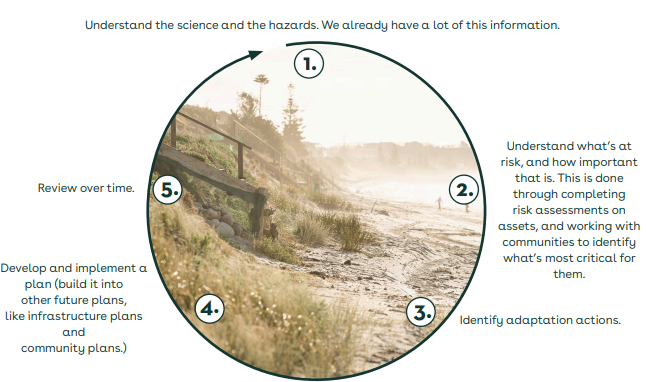
Because planning is iterative, decisions can be made as the as the most up-to-date information becomes available or when it becomes clear, from real-life conditions, that the level of risk can no longer be tolerated.
Some information that we need to understand what is at risk has already been collected, for example mapping of natural hazards for the current and possible future weather patterns. You can find out more about the natural hazards currently mapped for the Western Bay District on our website. The Toi Moana Bay of Plenty Regional Council regional climate change risk assessment is also a good resource for building understanding of the risks that Western Bay of Plenty District settlements, industries, and infrastructure may face in the future.
Once we understand what is at risk and what is most critical for our communities, we can begin to identify what options may be available to us under different climate scenarios. The options can then be investigated, so that any impacts on current and future residents are better understood, and preferred pathways developed.
By building each new iteration of preferred options and pathways into council’s future planning, such as infrastructure and community plans, we can avoid decisions that may not be suitable or affordable for a community if changes to the climate don’t progress as projected in the future.


